july 11th field testing
July 11, 2006
Date: July 11, 2006
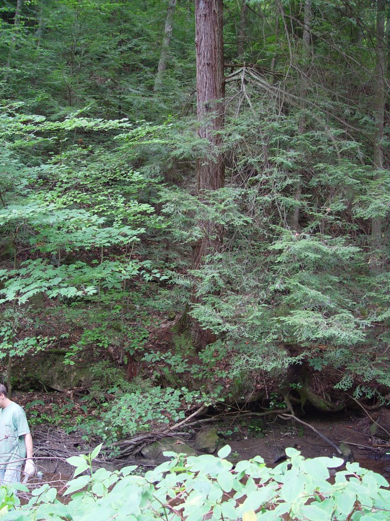
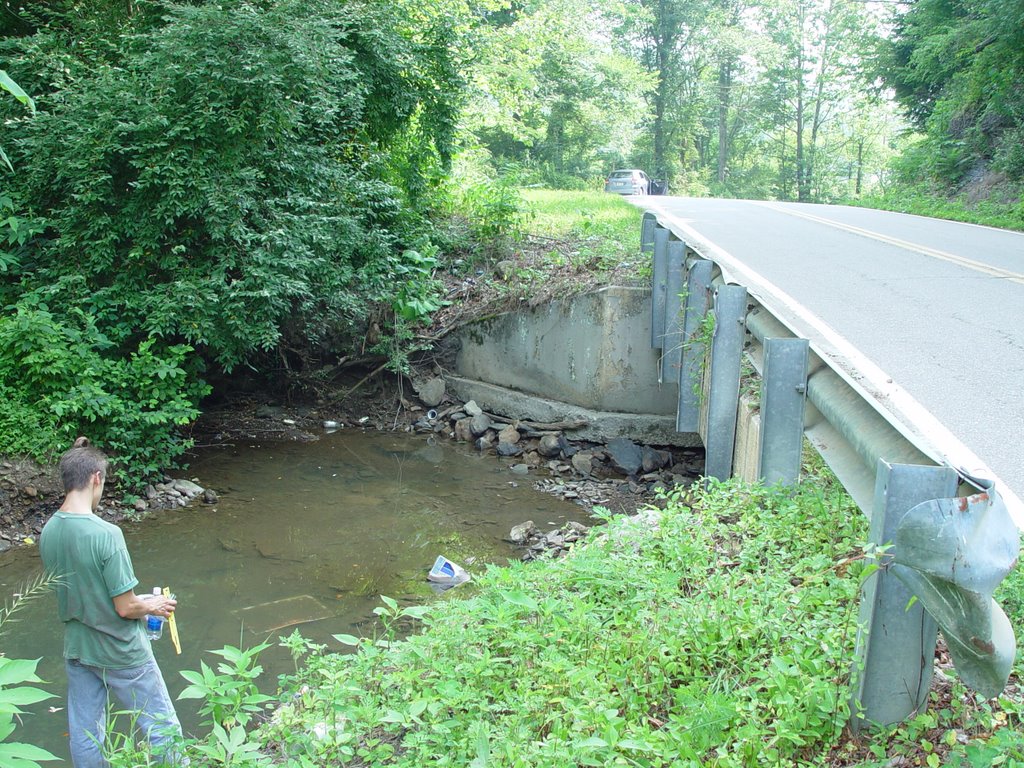
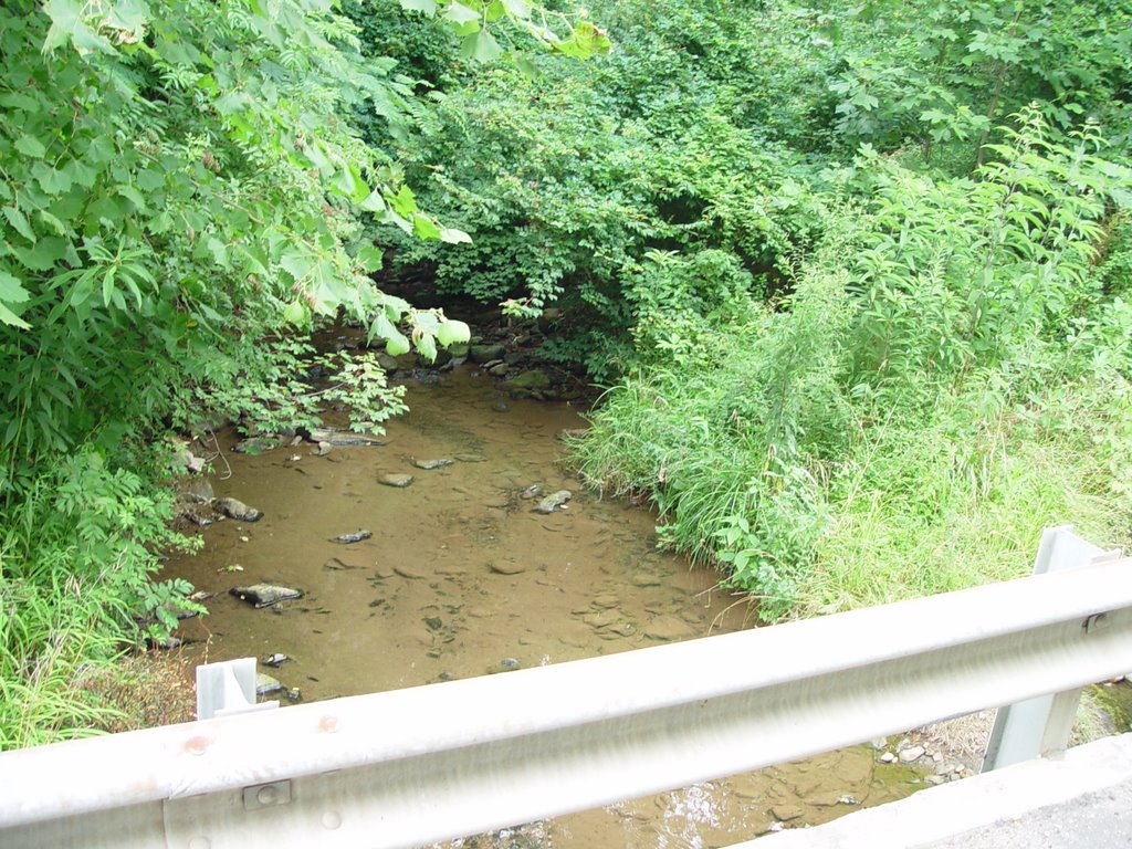
Site: BA
Bottle: BA
Pictures: 1-3
Water speed: 4
Turbidity:
Temperature: 16 C
GIS coordinates: N 36 deg 13.371
W 084 deg 09.494
Alt 880
Location: Approx. ½ mile south on Route 25 from Lake City exit on interstate 75. Right turn on Leech Avenue and ¼ mile down the Beech Grove River passes under Leech Ave. There are multiple houses nearby, one with an aboveground swimming pool and several with dogs, cornfield near river.
Appearance: fairly wide river, rocky, clear water
Plants: Johnson grass, other grasses
Animals:
Soil: totally vegetated back, no bare soil
Mileage: 101,494
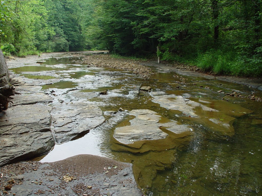
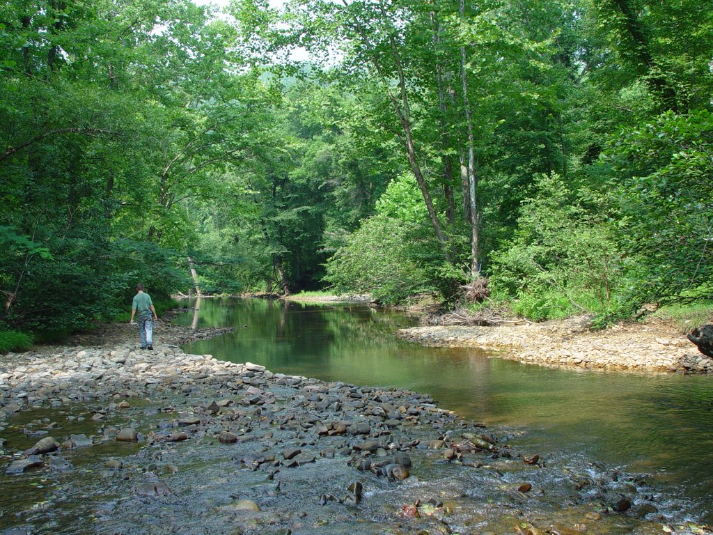
Date: July 11, 2006
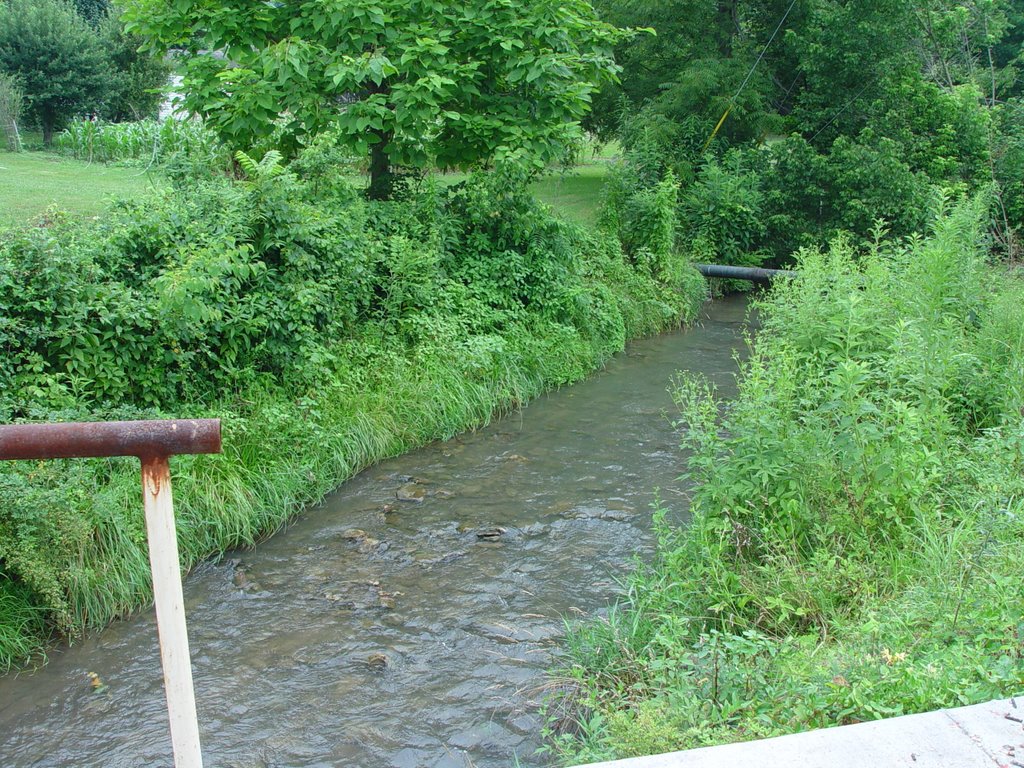
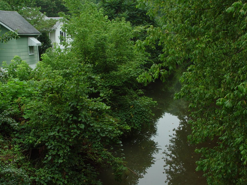
Site: BB
Bottle: BB
Pictures: 4-9
Water speed: 2.5 where flowing
Turbidity:
Temperature:
GIS coordinates: N 36 deg 13.224
W 084 deg 09.403
Alt 876
Location: On 25 South, about ¾ to 1 mile south of intersection with 75. Creek is flowing under the road. We parked at Lake City City Hall on right hand side of road. RR passes nearby. Several stores on each corner of intersection.
Appearance: Water level fairly low. Some parts flowing more than others, some areas stagnant
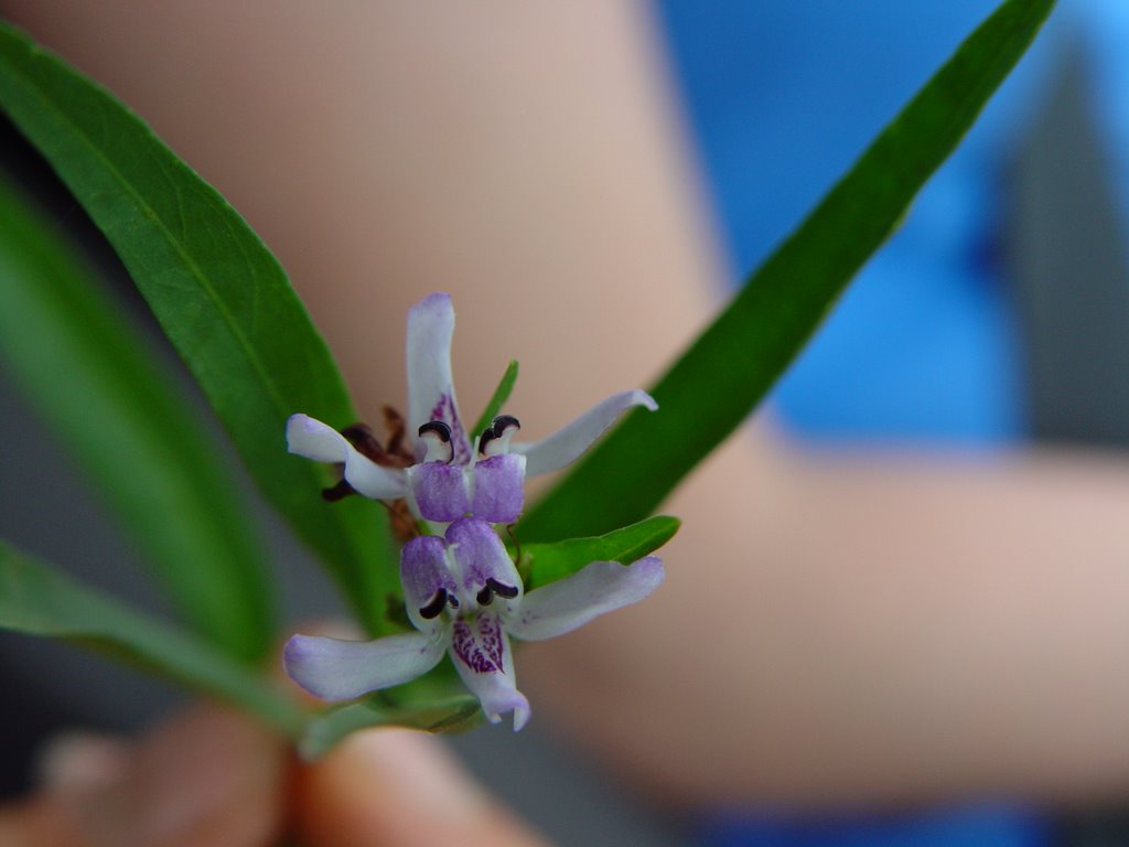
Plants: buttercups, Johnson grass, queen annes lace, ground ivy, mint, flax, mugwort, young maple trees, pretty white and purple flowers growing in and out of the water
Animals: yellow aphids on ground ivy
Soil: stony, sandy-not much bare dirt
Mileage: 101,494
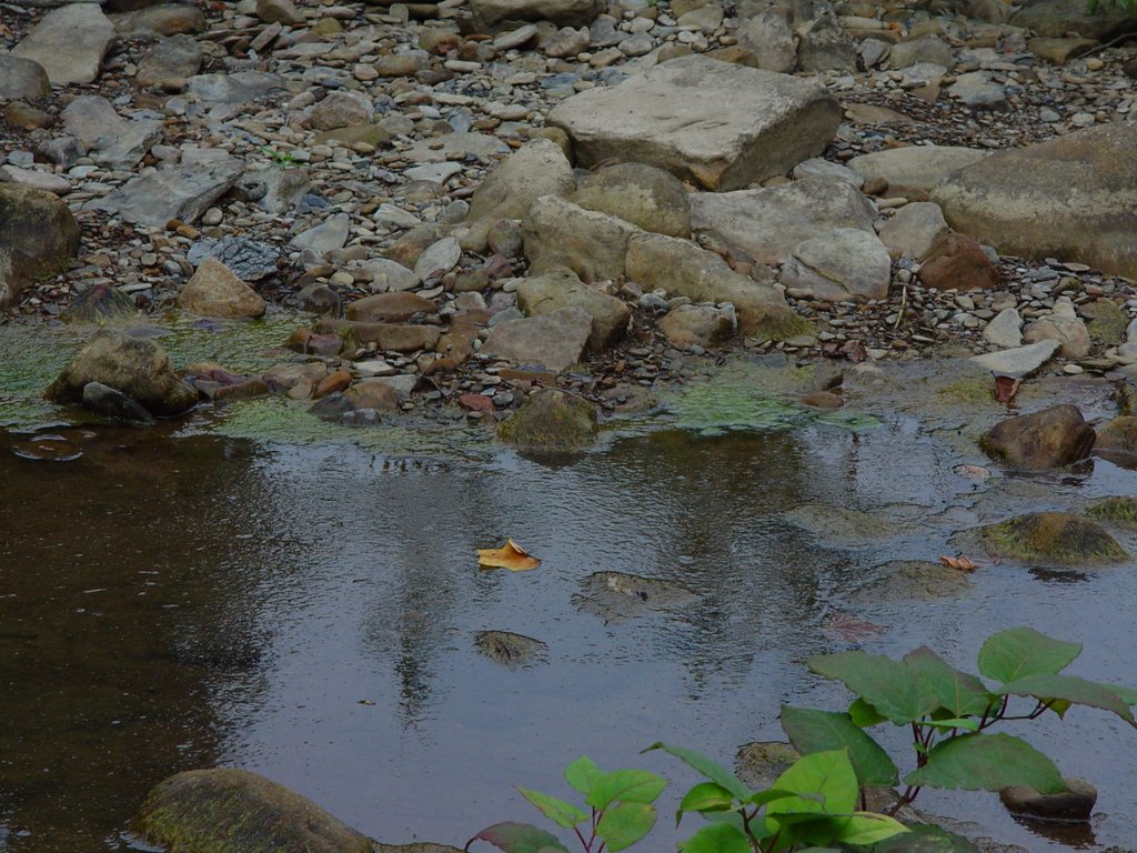
Date: July 11, 2006
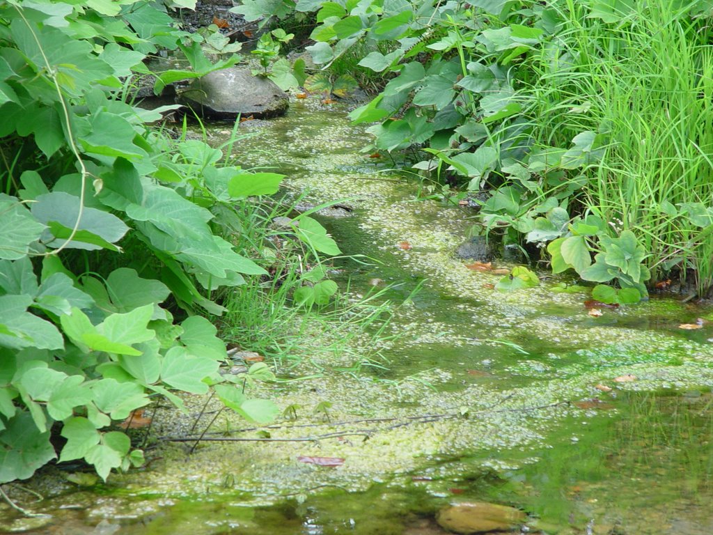
Site: BC
Bottle: BC
Pictures: 10-13
Water speed: 0.5
Turbidity: not applicable
Temperature: not applicable
GIS coordinates: N 36 deg 12.888
W 084 deg 09.989
Alt 861
Location: 1 mile south on 116 from split with 25 south outside of lake city. Water flows under Beech Grove Road on right hand side, near Wye Lane. Several houses and RR tracks nearby. Parked on right hand side of road, gravel pull in next to abandoned house
Appearance: water is low, clear. Some sediment on bottom. Grayish algae growing on rocks underwater.
Plants: honeysuckle, young maple trees, evergreens
Animals: several 10 inch fish, blue and white birds that kind of look like herrings in the water
Soil: sandy, muddy
Mileage: 101,498
Date: July 11, 2006
Site: BD
Bottle: BD
Pictures: 14-18
Water speed: 1.5
Turbidity: 20 JTU
Temperature: 22 C
GIS coordinates: N 36 deg 10.533
W 084 deg 11.143
Alt 934
Location: 1 mile south of Fraterville on 116, pulled off before Tennessee Hollow Rd. Creek is right hand side of road
Appearance: creek is low and slow moving. Rocks are slimy and there is lots of yellow/green/brown algae.
Plants: a few water crests, tons of kudzu, grass, maple trees
Animals: minnows
Soil: sandy/pebbly/rocky soil and slimy mud
Mileage: 101,502
Notes: sort of stagnant smell
Date: July 11, 2006
Site: BE
Bottle: BE
Pictures: 19-25
Water speed: 0.5
Turbidity: 40 JTU
Temperature: 20 C

GIS coordinates: N 36 deg 08.129
W 084 deg 12.970
Alt 1086
Location: 116 south near mile marker 12. Pulled off on left hand side of road. We believe it was Poplar Creek.
Appearance: There is a fire pit near creek and lots of trash in water and on the bank including a paint can and a few motor oil bottles. Creek is sedimented on bottom, water level is low and algae is growing on rocks underwater and moss is growing on rocks and trees on/near the bank.
Plants: jewel weed, ferns, hemlock trees, maple trees, oak trees, weeds
Animals: big ½ inch long darterfish, monarch butterfly
Soil: muddy sand
Mileage: 101,505
Date: July 11, 2006
Site: BF
Bottle: BF
Pictures: 27-32
Water speed: 2
Turbidity: 0 JTU
Temperature: 24 C
GIS coordinates: N 36 deg 11.544
W 084 deg 17.799
Alt 2198
Location: Ligias River before it meets New river on 116 south. Pulled off on left hand side of the road
Appearance: some tan/orangeish algae (natural colors)
Plants: oaks, maples, princess tree, typical assortment
Animals: ghost fish and other 8-11 inch fish
Soil: rocky, sandy soil
Mileage: 101,515
Date: July 11, 2006
Site: BG
Bottle: BG1= Ligias R.
BG2= intersection BG3=New R.
Pictures: 33-40
Water speed: 3 at mouth of river 2 farther down river
Turbidity: 10 JTU
Temperature: 23 C
GIS coordinates: Up New River from Ligias intersection:
N 36 deg 12.523
W 084 deg 19.327
Alt 1450
Where Ligias R. meets New River:
N 36 deg 12.510
W 084 deg 19.336
Location: Parked at intersection of New River Rd. and the 116 “switchback” near Stainville. Point where Ligias River converges with the New River. Same as site AN from 7/9/06
Appearance: both are quickly moving water, wide rivers with clear water. Some sediment and algae. Some orange foam on surface of water at some points
Plants: mimosa, poison ivy, grasses, oak and maple trees
Animals: frog, darter fish, 2 inch fish wirh rainbow sides
Soil: sandy, muddy
Mileage: 101,519 (after about 1.5 miles of backtrcking)
Date: July 11, 2006
Site: BH
Bottle: BH
Pictures: 41-43
Water speed: 0
Turbidity: 15 JTU
Temperature: 24 C
GIS coordinates: N 36 deg 09.969
W 084 deg 21.513
Alt 1376
Location: 116 near mile marker 7. Water is flowing under the road. Pull off on left hand side.
Appearance: looks like an ephemeral stream, was underground and had picked back up on the surface. Some oil on surface of water.
Plants: rosasharon, grasses, weeds
Animals: lots of little fish
Soil: squishy, muddy, sandy
Mileage: 101,524
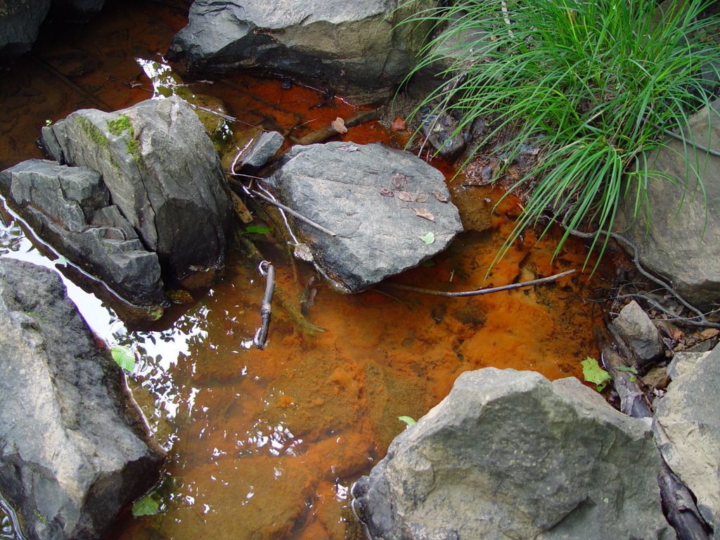
Date: July 11, 2006
Site: BI
Bottle: BI
Pictures: 39, 40 from 7/9/06
Water speed: 1.5
Turbidity: 20 JTU
Temperature: 24 C
GIS coordinates: N 36 deg 09.339
W 084 deg 22.618
Alt 1438
Location: New River Rd/116 about ½ mile from intersection with Smoky Creek Rd (is it still called that at this point?), ½ mile from coal processing plant. River is flowing under bridge. Nearby garden on right hand side of road, RR tracks cross road.
Appearance: good flow, wide river, but water is low
Plants: mossy rocks on banks, regular grasses and weeds, oaks and maples
Animals: water bugs, 2-5 inch fish
Soil: sandy soil
Mileage:
Date: July 11,2006
Site: BJ
Bottle: BJ
Pictures: 44-49
Water speed: 1
Turbidity: 0
Temperature: 24 C
GIS coordinates: N 36 deg 07.675
W 084 deg 24.291
Alt 1544
Location: 116 south, about 3 miles south of coal process plant. Cemetery nearby. Power lines cross the road. Stream passes under the road.
Appearance: very low water, rocky stream moving slowly
Plants: mimosa, oaks, black berries, bull thistle, queen annes lace
Animals: inch worm, too low for fish
Soil: sandy
Mileage: 101,528
Date: July 11,2006
Site: BK
Bottle: BK
Pictures: 50-51
Water speed: 1
Turbidity: 20 JTU
Temperature: 20 C
GIS coordinates: N 36 deg 07.495
W 083 deg 25.402
Alt 1549
Location: 116 south, approx. ½ mile south of Beech Grove Baptist Church. Pull off on right hand side of road, river passes under the road.
Appearance: lots of green algae
Plants: colts foot, queen annes lace, red stemmed bush with white flowers
Animals:
Soil:
Mileage: 101,529
Date: July 11,2006
Site: BL
Bottle: BL
Pictures: 53-55
Water speed: 0.5
Turbidity: 5 JTU
Temperature: 28 C
GIS coordinates: N 36 deg 06.074
W 084 deg 26.829
Alt 1437
Location: on 116 south, ¼ mile past Brushy Mountain State Penitentary. Pulled off on right hand side of road. Power lines cross roads. Several nearby houses, most are abandoned. Fire hydrant and sewer man hole nearby.
Appearance: appears as though area had been clear cut sometime ago, lots of mowed grass, all trees had been removed. There is also a water treatment facility nearby.
Plants: grass
Animals: water bugs, swallows in water
Soil: covered with grass
Mileage: 101,533
Note: stale smell to water
Date: July 11,2006
Site: BM
Bottle: BM
Pictures: 56-59
Water speed: 1
Turbidity: 10 JTU
Temperature: 25 C
GIS coordinates: N 36 deg 05.694
W 083 deg 26.762
Alt 1430
Location: Follow 116 through a hard right, about 1 mile past the Penitentiary. Stream flows under the road. There are several nearby houses, one is abandoned. Near mile marker 2.
Plants: tulip poplar, oak and maple trees
Animals: waterbugs, school of ghost fish
Soil: sandy
Mileage: 101,533
Notes: smells fishy
Date: July 11,2006
Site: BN
Bottle: BN
Pictures: 3-5 of card #2
Water speed: 0.1
Turbidity: 30 JTU
Temperature: 26 C
GIS coordinates: N 36 deg 04.058
W 084 deg 27.212
Alt 1340
Location: ½ mile down 62 East from intersection with 116. Water is flowing under bridge. Power lines on both sides of the road.
Appearance: under the bridge the water is very stagnant and oily and passes into the clear part of the river.
Plants: river cane, young maples, queen annes lace, weeds and other plants, mimosa flowers, yellow flower with red center (photo 5)
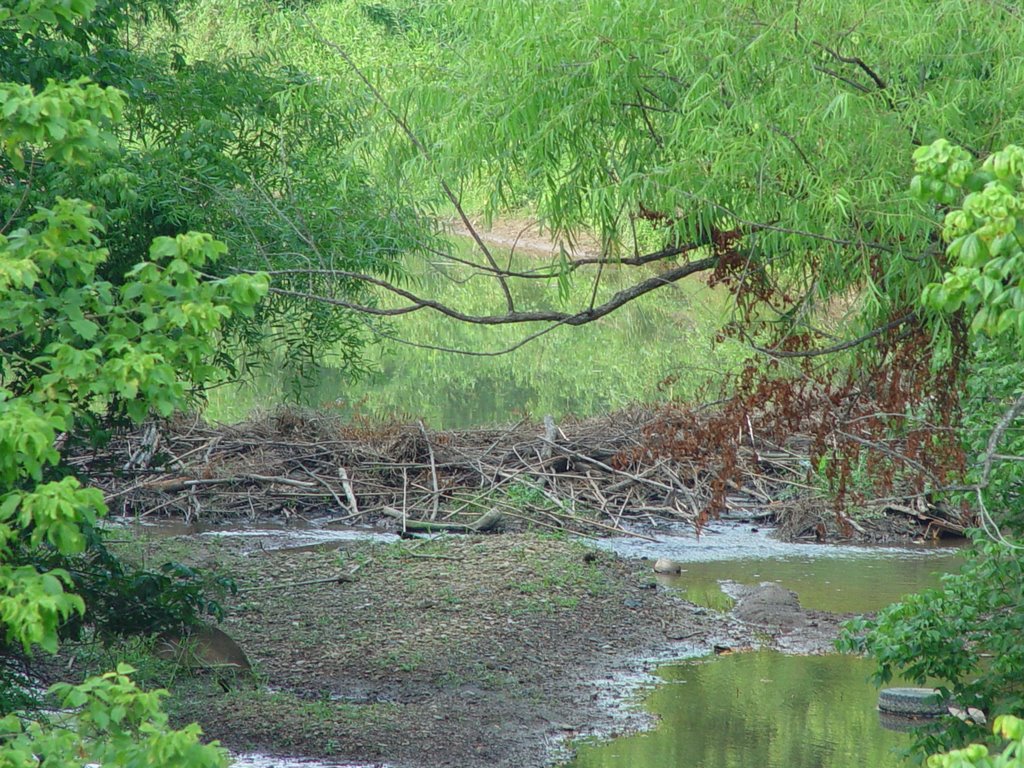
Animals: water bugs, possible beaver dam (?), about 10 horses live nearby
Soil: muddy/sandy
Mileage: 101,536
Notes: stagnant, unpleasant smell
Date: July 11,2006
Site: BO
Bottle: BO
Pictures: 6-7
Water speed: 1
Turbidity: 15 JTU
Temperature: 24 C
GIS coordinates: N 36 deg 03.182
W 084 deg 26.354
Alt 1199
Location: on 62 East, just past mile marker 30. There is a 100ft rockface to left side of road, water is accessible from right side of road.
Appearance:
Plants: wild oats, grasses and weeds, maple and oak trees
Animals: 1.5-2 inch fish
Soil: sandy, stony mud
Mileage: 101,537
Notes: musty smell near water
Date: July 11,2006
Site: BP
Bottle: BP1=above small bridge
BP2= below small bridge
Pictures: 8-12
Water speed: 0.5
Turbidity: 10 JTU
Temperature: 24 C
GIS coordinates:
Location: 62 East past mile marker 35. Pulled off to right hand side. Water flows under 62, next to Big Mountain Baptist Church. “Small bridge” refers to bridge over Big Mnt Church Rd, not 62. Power lines cross the river. There is a park across from the church.
Appearance: There are clear cuts going on very close by, one on either side of 62. There are two small feeder streams here that bubble up from underground. Water is slow/low and the rocks are covered with slimy black algae. There is some brown and bubbly 1 inch thick sediment gunk on surface of water in some places.
Plants: grassy bank, plantain, clovers, mullen
Animals: minnows and darter fish
Soil: sandy, blackish mud
Mileage: 101,543
Notes: There is a smell like dead animal in the water. There is a park and a house nearby, and a kid’s floaty tube water toy in the creek. It is obvious that families recreate here often.
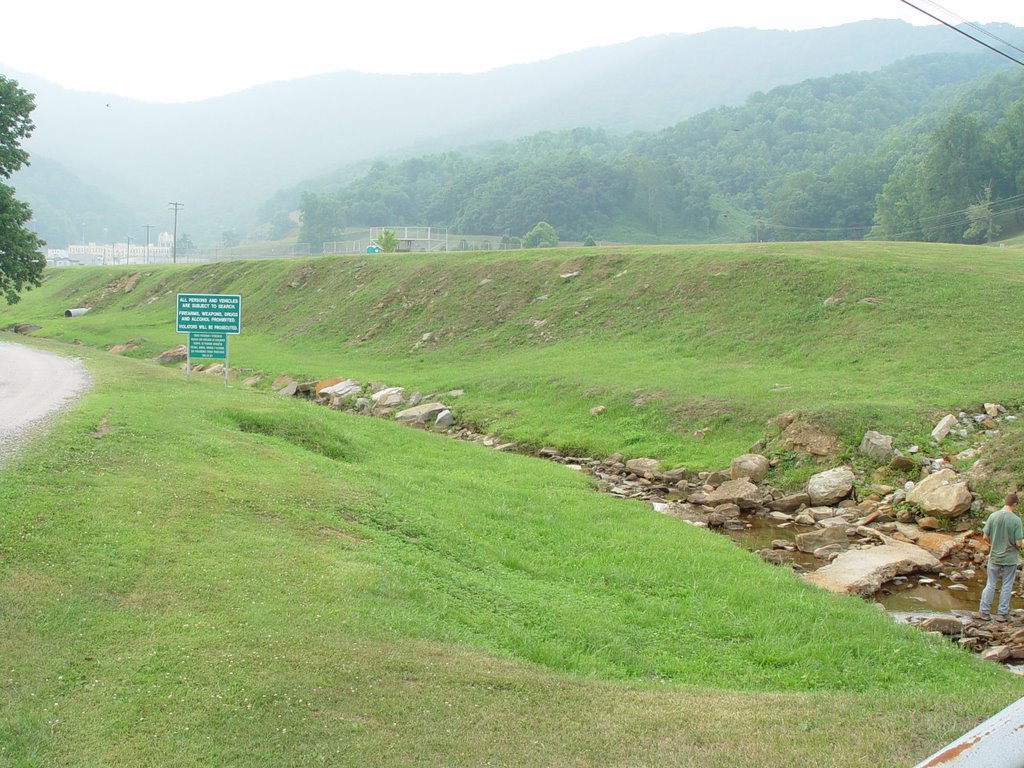
Date: July 11, 2006
Site: BQ
Bottle: BQ
Pictures: 13-16
Water speed: 1.5
Turbidity: 50 JTU
Temperature: 24 C
GIS coordinates: N 36 deg 02.786
W 084 deg 21.796
Alt 778
Location: 62 east about ¼ mile from site BP, pull off on Big Mountain Hollow Rd. on left hand side. About 1.5 miles from junction with 61. There are clear cuts on either side on the road here.
Appearance: cut runs straight into the river. Water is clear, but heavy and brown sediment at bottom
Plants: black berries, kudzu, young maples, oak trees
Animals: minnows
Soil:
Mileage: 101,543
posted by petunia @ 7:33 PM
0 comments
![]()
